

Collection: Osher Map Library Collection
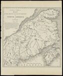
Name: Extract from a Map of the British and French Dominions in North America
Barcode:
Image Number:
Creator:
Printmaker:
From Atlas:
Publishing Location:
Notes: Note: "This map was undertaken with the approbation and at the request of the Lords Commissioners for Trade and Plantations; and is chiefly composed from draughts, charts and actual surveys of different parts of His Majesties colonies and plantations in America; great part of which have been lately taken by their Lordships Orders and transmitted to this office by the governors of the said colonies and others." John Pownall, Secretary
Brief Description:
Physical Description:
Date/Date Range Produced:
Date/Date Range Published:
Language:
Region Depicted:
Map Type:
Printing Process:
Printing Technique:
Material Type:
OCLC: 900987221
Donor:
Subjects:
Permanent URL: