

Collection: Osher Map Library Collection
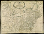
Name: A General Map of the Middle British Colonies, in America. containing Virginia, Maryland, the Delaware counties, Pennsylvania and New Jersey, with the addition of New York and the greatest part of New England as also of the bordering parts of the province of Quebec, improved from several surveys made after the late war, and corrected from Governor Pownall's late map, 1776
Barcode:
Image Number:
Creator:
Alternative Title:
Physical Description:
Date/Date Range Produced:
Date/Date Range Published:
Language:
Dimensions: 48 x 66
Printing Process:
Printing Technique:
Material Type:
Notes: Inset: "A Sketch of the Upper Parts of Canada"
LC Call Number: G3710 .S3 1776
OCLC: 244484359
Accession Number: OML-1776-27
Permanent URL: