

Collection: Hamilton Collection
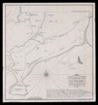
Name: A Map of Black Point from the 1844 copy of a plan made by John Godsoe, Surveyor, for the use of ye Supreme Court in ye case of Prout and Trickey -- June AD 1741
Barcode:
Image Number:
Date/Date Range Published: Jul 1927
Language:
Dimensions: H 57 x W 53 cm
Notes: Loaned by Prof. Hamilton for digitization and public view.
Accession Number: LOAN-2019-14
Permanent URL: