

Collection: Osher Map Library Collection
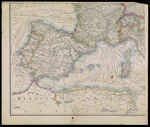
Name: [Map of part of Europe and Northern Africa]
Barcode:
Image Number:
Creator:
Publishing Location:
Notes: Title supplied by cataloger. Map shows location of telegraph cables.
Date/Date Range Produced:
Date/Date Range Published:
Language:
Dimensions: 75 x 90 cm on sheet 81 x 97
Physical Description: 1 map: colored, illustrated (1 part of 4 part set)
Accession Number: OML-1940-1
Permanent URL: